proven. reliable. trusted.
3D CAPTURE INSIGHT
Choosing a 3D Capture Solution
A guide to the attributes of a 3D Capture model — and what it takes off your team's plate.
TECHNICAL GUIDANCE PAPER
A practical guide for operations, maintenance, engineering and project teams comparing a LiDAR-based 3D Capture solution against traditional site surveys and manual documentation.
00 OVERVIEW
What is a 3D Capture solution — and what value does it bring?
From a single site visit to a fully measurable, navigable digital twin your whole team can use.
50K+
SQ. FT. CAPTURED PER PERSON, PER DAY
~2–4mm
POINT-CLOUD DIMENSIONAL PRECISION
3
BUSINESS DAYS TO A HOSTED MODEL
1-click
ASSET ACCESS FROM IBM MAXIMO
01 HOW THE TECHNOLOGY WORKS
LiDAR, explained
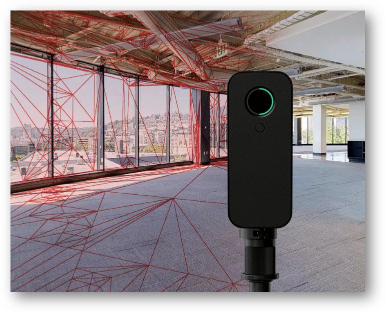
The capture camera answers one question: what does this space actually look like, down to the millimeter? It uses LiDAR (Light Detection and Ranging) to fire laser pulses at every surface and measure the time each pulse takes to return, building a precise 3D point cloud as the operator moves through the site.
A 360° camera captures true-color imagery at the same time. That imagery is overlaid on the point cloud, so the finished model looks and feels like the real space rather than a bare wireframe.
The result is a single dataset that is simultaneously a photorealistic walkthrough and a millimeter-accurate measurement record — with schematic floor plans and print-quality 4K photography generated from the same capture.
02 THE CAPTURE PROCESS
From site visit to production use
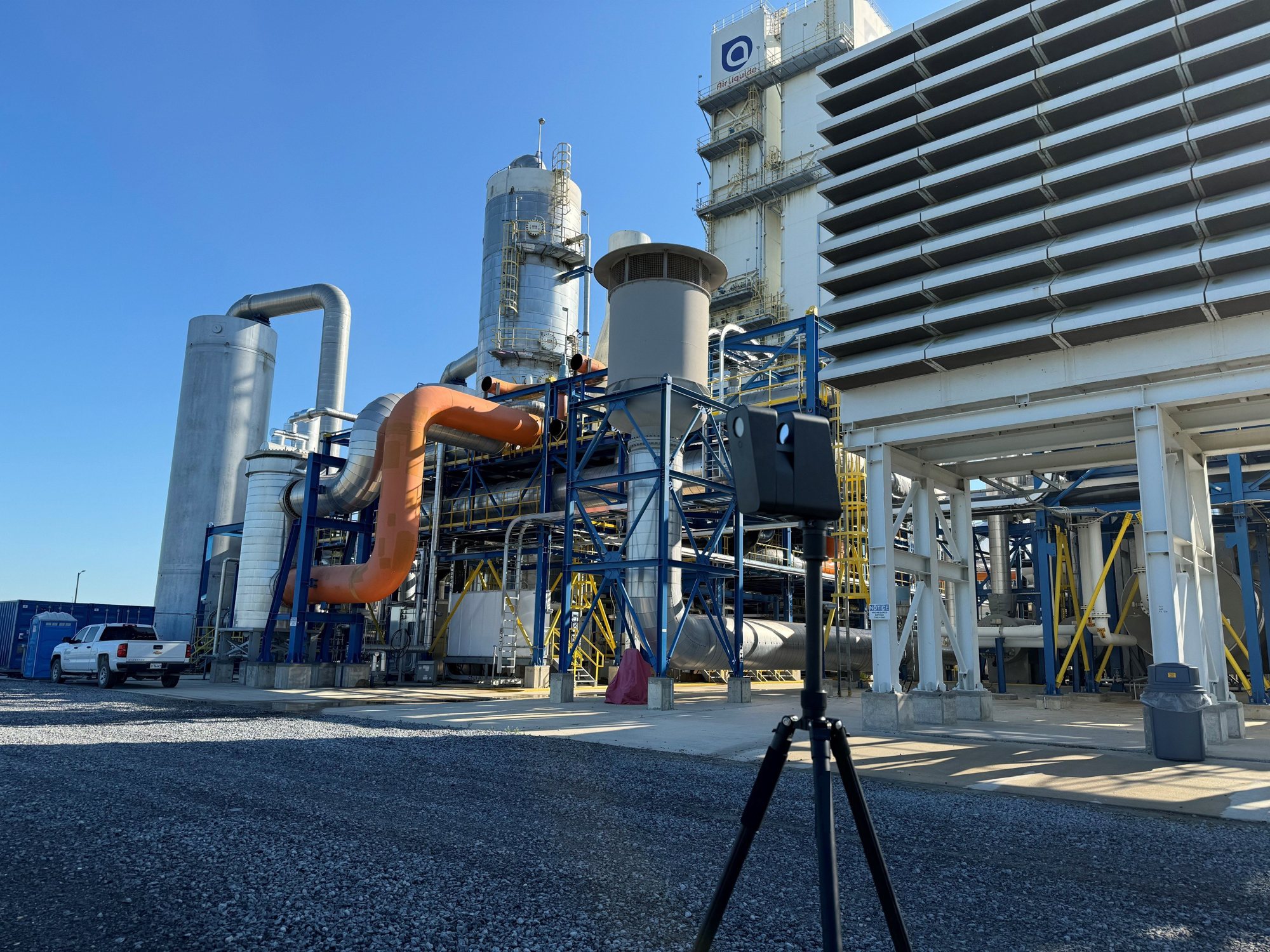
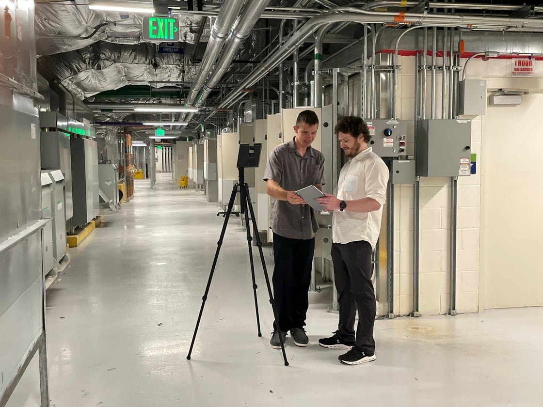
A technician walks the space with the capture camera at roughly 50,000 square feet per person per day, so most facilities are fully captured in a single visit — with zero disruption to ongoing operations. From there, the raw scan moves through a defined pipeline before it reaches your team.
-
01
BEFORE THE VISIT
Scope & planning
A site walkthrough to define capture zones and align on asset-tagging conventions, integration requirements and security protocols.
-
02
ON SITE
LiDAR capture
A technician scans on foot, capturing point-cloud geometry and 360° imagery together — about 50,000 SF per person per day.
-
03
POST-PROCESSING
Processing & tagging
Scans are stitched, cleaned and uploaded. Equipment is tagged in the model with nameplate data, manuals and documents attached — exportable to a spreadsheet for bulk editing.
-
04
GO-LIVE
Delivery & support
Your team receives a secure link to the finished, navigable model — no software to install — with EAM/CMMS integration live and ongoing SMS support.
TYPICAL DELIVERY TIMELINES
3 business days
Hosted, shareable 3D model ready for your team
10 business days
Model with equipment and asset tagging applied
6–8 weeks
Full Scan-to-BIM deliverable for design and engineering
03 THE FINAL DELIVERABLE
What you get — and what it replaces
| DIMENSION | SMS 3D CAPTURE SOLUTION | TRADITIONAL ALTERNATIVE |
|---|---|---|
| Site measurements | Millimeter-accurate measurements of the entire space, captured once | Taken by hand — prone to human error and missed areas |
| Viewing the space off-site | Fully immersive, easy-to-navigate online model, accessible from any computer | Flying out to the site or reviewing static photos — costly and rarely comprehensive |
| Documentation completeness | 100% of the visible environment, including overhead MEP, structural steel and hard-to-reach areas | Only what a surveyor remembers to measure; hidden elements are often missed |
| Dimensional accuracy | Point-cloud precision to within roughly 1.9–4mm | Tape-measure methods carry inconsistent, uncontrolled tolerances |
| Asset information | Tagged equipment linked to maintenance records, P&IDs and inspection history in IBM Maximo | Nameplate data and manuals scattered across binders, drives and memory |
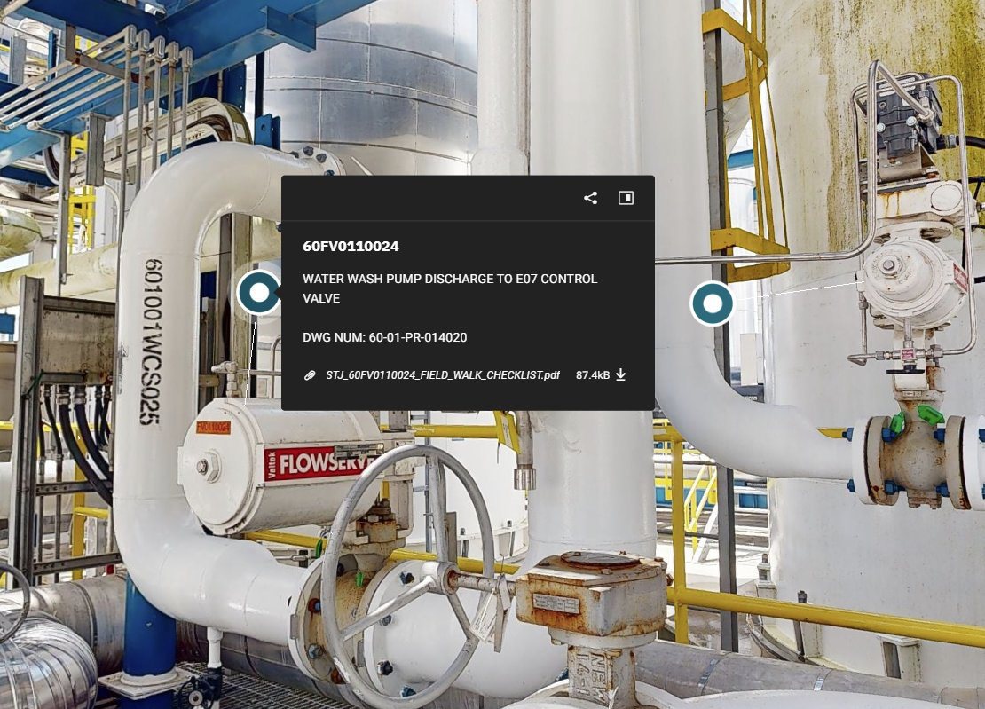
EAM-LINKED DOCUMENTATION
Every asset, in context
Tags placed directly in the model carry the details your technicians need — tag number, service description, drawing reference and attached documents such as field-walk checklists and O&M manuals.
Because SMS is an IBM Platinum Business Partner, the model connects to IBM Maximo: click an asset, see its work history, and plan the approach — with the same accurate view for every stakeholder.
BEYOND THE WALKTHROUGH — OUTPUTS FROM ONE CAPTURE
Schematic floor plans
Measured 2D plans generated from the scan for space planning and layout work.
Point cloud & BIM
Exportable geometry for CAD, BIM and design-and-construction platforms.
Print-quality imagery
High-resolution stills for reports, audits and bid packages.
CORE CAPABILITIES
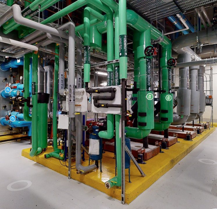
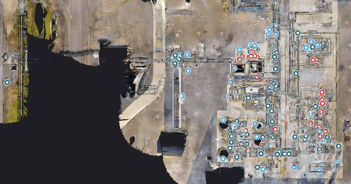
Six ways 3D Capture delivers immediate value
05 WHY IT MATTERS: THE BUSINESS CASE
From a single site visit to measurable savings across the project
The value of a 3D Capture model shows up long before the final walkthrough — in the hours, trips and change orders it removes from a project.
| BUSINESS LEVER | IMPACT | REAL-WORLD / FIELD EVIDENCE |
|---|---|---|
| Site survey speed | ↑ 70–80% | A traditional six-hour manual survey is often completed in about 90 minutes with laser-based capture — 4–5× the documentation speed. |
| Change orders & rework | ↓ up to 75% | Point-cloud precision of roughly 1.9–4mm lets prefabricated components fit correctly the first time, virtually eliminating field adjustments. |
| Site revisits | ↓ up to 90% | Comprehensive first-visit capture removes the travel and labor cost of sending a technician back for a forgotten measurement. |
| Project initiation timeline | ↓ 50–60% | As-built drawings and BIM coordination models are produced in a fraction of the time when all data is captured on the first visit. |
| Material waste | ↓ 20–30% | Precise dimensional data lets teams order exactly what's needed instead of over-ordering to cover hidden irregularities. |
| Capital planning & renovation estimating | ↓ 3–5%ON BIDS | Millimeter-accurate as-built data supports tighter contractor scoping and more reliable estimates; one utility investing $250–300M a year in capital projects reports up to 400% ROI from digital-twin-based planning. |
Industry estimates put rework and design clashes at up to 20% of a typical project budget; teams equipped with reality capture bring that below 5%.
Source: published reality-capture industry data.
WHO USES IT
Four teams. One model. Different problems solved.
-
MAINTENANCE & RELIABILITY
Plan outages without guessing
Link work orders to exact locations, verify isolation points before arriving, and brief contractors on equipment they've never seen.
Click asset → See work history → Plan approach
-
ENGINEERING & PROJECTS
Design with real constraints
Verify clearances before equipment ships, route large components through actual spaces, and compare as-built to drawings in minutes.
Measure → Route → Validate → Install
-
SAFETY & TRAINING
Train before they arrive
Walk new hires through equipment virtually, review incident locations remotely, and build spatial awareness without site access.
Orient → Familiarize → Assess → Deploy safely
-
REMOTE COLLABORATION
Coordinate without travel
Give engineers full context from their desk, show contractors exactly where to go, and get vendor input without a site visit.
Share link → Review together → Approve remotely
INDUSTRY EXPERIENCE
Proven in complex, high-stakes environments
TURNAROUND PLANNING
Manufacturing & production
Continuous process, batch and pharma/GMP facilities
SAFETY TRAINING
Energy & utilities
Power generation, substations, water/wastewater
CAPACITY PLANNING
Data centers & mission-critical
Hyperscale, colocation, critical infrastructure
WAYFINDING & M&E TRACKING
Healthcare & campuses
Hospital, university and corporate campuses
COMPLIANCE AUDITS
Transportation & airports
Terminals, rail stations, ports, transit centers
LAYOUT OPTIMIZATION
Distribution & logistics
Fulfillment centers, cold storage, cross-docks
“Reduced our turnaround planning time by 40% and eliminated multiple site visits. The Maximo integration is seamless.”
06 THE BOTTOM LINE
One capture. No second trip.
Choosing between a 3D Capture model and a traditional survey isn't really a technology decision — it's a decision about how many times your team is willing to measure, visit and re-check the same space. A single capture replaces the return trips, the missed measurements and the change orders that come from working off memory and photos. It is faster, more accurate, and reusable for the life of the space.
PARTNER WITH SMS
Strategic Maintenance Solutions has delivered 1,000+ successful projects for Fortune 1000 organizations over 25+ years. We scope, capture and deliver — with the EAM integration expertise a general scanning firm can't match. Talk to an SMS engineer about how 3D Capture can support training, planning and asset documentation for your facility.
- GENERAL INQUIRY
- sales@sms-inc.net
- PHONE
- +1 207-854-9400
- LEARN MORE
- www.sms-inc.net/3d-capture
- HEADQUARTERS
- 12 Estate Drive, Gorham, ME 04038
© 2026 STRATEGIC MAINTENANCE SOLUTIONS, INC.